

Key Takeaways
- Summer temperatures in the Southwest regularly exceed 110°F in low-elevation areas like Death Valley and the Grand Canyon floor.
- Many iconic trailheads and backcountry roads sit above 6,000 feet, making altitude a genuine planning factor.
- Water sources are scarce and unreliable — carrying extra is not optional, it's essential.
- The region rewards travelers who prepare logistics in advance, especially for camping permits and remote road access.
- Despite its challenges, the Southwest offers some of the most visually dramatic and culturally rich landscapes in the country.
Unmatched geological drama and visual scale
The canyon systems, hoodoo fields, and slickrock expanses of the Southwest are without parallel in the continental US, offering scenery that photographs simply cannot prepare you for.
Extraordinary concentration of public land access
The region is home to dozens of national parks, monuments, and Bureau of Land Management areas, giving visitors exceptional range without needing to navigate private property.
Rich Indigenous and colonial cultural history
From ancient Ancestral Puebloan cliff dwellings to living tribal nations and Spanish colonial heritage, the Southwest offers cultural depth that most US destinations can't match.
World-class dark skies for stargazing
Low population density and minimal light pollution make parts of the Southwest among the best places in the country for night-sky viewing, including designated International Dark Sky Parks.
Accessible for road trip formats
Major parks and scenic routes connect logically, making the Southwest one of the most rewarding regions to explore by car over one to three weeks.
Extreme summer heat poses genuine health risks
Low-elevation areas regularly exceed 110°F between June and August. Heat exhaustion and heat stroke are real risks on exposed trails, even on short hikes attempted without adequate water.
Water is scarce and cannot be assumed
Many trails and backcountry routes have no reliable water sources. Carrying far more water than you think you'll need — commonly cited as a minimum of one liter per hour of activity — is essential.
Altitude affects visitors at multiple popular sites
Cities and parks from Santa Fe to Bryce Canyon sit above 6,000–8,000 feet. Altitude sickness, fatigue, and dehydration are common for visitors arriving from sea level without an acclimatization day.
Popular permits are highly competitive
Access to destinations like The Wave in the Vermilion Cliffs and Havasupai Falls requires permit lotteries with low odds; planning around rejection or entering months early is necessary.
Remote roads demand vehicle and driver preparedness
Many scenic routes require high-clearance or four-wheel-drive vehicles, and cell service gaps are common. Breakdowns in remote areas can become serious situations quickly without preparation.
Our Verdict
The American Southwest is genuinely extraordinary — layered with geological drama, Indigenous history, and a kind of open-sky freedom found almost nowhere else in the country. But it earns its reputation as unforgiving. Heat, altitude, limited water, and remote infrastructure gaps can turn an underprepared trip into a dangerous one. Respect the landscape and plan accordingly, and you'll find the payoff remarkable.
Best suited to travelers who enjoy doing logistical homework, are comfortable in heat and remote settings, and want landscapes that feel genuinely unlike anywhere else in the US.
Why the Southwest Draws Millions — and Humbles Just as Many
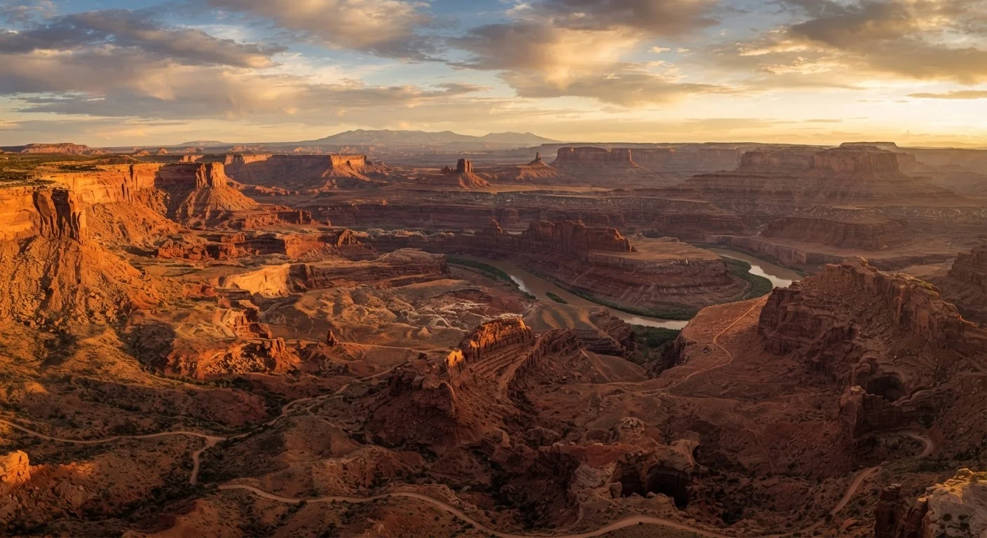
Few regions in the United States hit as hard on arrival as the American Southwest. The colors alone — burnt sienna, bone white, deep violet — feel almost implausible against an open blue sky. Spanning parts of Arizona, Utah, New Mexico, Nevada, and Colorado, this region holds some of the country's most iconic public land: Grand Canyon, Zion, Arches, Bryce Canyon, Saguaro, and dozens of less-visited gems detailed in our guide to America's lesser-known desert landscapes.
But the same forces that sculpted those landscapes — extreme aridity, violent temperature swings, thin air at elevation — make visits genuinely demanding. The Southwest isn't hostile to tourists so much as indifferent. It doesn't adjust to you; you adjust to it. Understanding what the landscape actually requires is the difference between an unforgettable trip and a preventable emergency.
Unmatched geological drama and visual scale
The canyon systems, hoodoo fields, and slickrock expanses of the Southwest are without parallel in the continental US, offering scenery that photographs simply cannot prepare you for.
Extraordinary concentration of public land access
The region is home to dozens of national parks, monuments, and Bureau of Land Management areas, giving visitors exceptional range without needing to navigate private property.
Rich Indigenous and colonial cultural history
From ancient Ancestral Puebloan cliff dwellings to living tribal nations and Spanish colonial heritage, the Southwest offers cultural depth that most US destinations can't match.
World-class dark skies for stargazing
Low population density and minimal light pollution make parts of the Southwest among the best places in the country for night-sky viewing, including designated International Dark Sky Parks.
Accessible for road trip formats
Major parks and scenic routes connect logically, making the Southwest one of the most rewarding regions to explore by car over one to three weeks.
What Makes the Southwest So Worth the Effort
The case for visiting is overwhelming if you go in clear-eyed. The scale of the geology is difficult to convey in photographs — standing on the South Rim of the Grand Canyon or watching first light hit Delicate Arch in Arches National Park registers physically in a way few travel experiences do.
Cultural depth adds another dimension. The region is home to dozens of Native nations with living traditions, and places like Chaco Culture National Historical Park or Monument Valley Navajo Tribal Park offer context that no other US destination matches. New Mexico's art towns — Taos, Santa Fe, Abiquiú — layer creative and culinary richness onto an already compelling natural canvas. Santa Fe itself sits above 7,000 feet, so check our high-altitude destination guide before you go.
Road tripping connects it all. Long stretches of US-89, Highway 12 in Utah, or the Turquoise Trail in New Mexico rank among the most scenic drives in the country. Our breakdown of road trips versus fly-and-explore formats can help you decide which approach fits your schedule and style.
The Real Challenges You Need to Plan Around
The Southwest's downsides aren't trivial, and minimizing them honestly matters for safety.
Extreme summer heat poses genuine health risks
Low-elevation areas regularly exceed 110°F between June and August. Heat exhaustion and heat stroke are real risks on exposed trails, even on short hikes attempted without adequate water.
Water is scarce and cannot be assumed
Many trails and backcountry routes have no reliable water sources. Carrying far more water than you think you'll need — commonly cited as a minimum of one liter per hour of activity — is essential.
Altitude affects visitors at multiple popular sites
Cities and parks from Santa Fe to Bryce Canyon sit above 6,000–8,000 feet. Altitude sickness, fatigue, and dehydration are common for visitors arriving from sea level without an acclimatization day.
Popular permits are highly competitive
Access to destinations like The Wave in the Vermilion Cliffs and Havasupai Falls requires permit lotteries with low odds; planning around rejection or entering months early is necessary.
Remote roads demand vehicle and driver preparedness
Many scenic routes require high-clearance or four-wheel-drive vehicles, and cell service gaps are common. Breakdowns in remote areas can become serious situations quickly without preparation.
When to Go: Timing Changes Everything
Timing is the single most controllable variable. Spring (mid-March through May) and fall (September through early November) offer the most forgiving conditions in most of the region. Summer is feasible at higher elevations — Bryce Canyon, for instance, sits above 8,000 feet — but brutal at low-elevation parks. Always verify seasonal conditions with the specific park or public lands agency before booking.
Timing is the single most controllable variable. Spring (mid-March through May) and fall (September through early November) offer the most forgiving conditions in most of the region. Summer is feasible at higher elevations — Bryce Canyon, for instance, sits above 8,000 feet — but brutal at low-elevation parks. Always verify seasonal conditions with the specific park or public lands agency before booking.
Practical Planning: The Short Version
A few logistics make the difference between smooth and stressful. Permit systems at Zion's Narrows, Havasu Falls, and Wave require applications months in advance — sometimes via lottery. Check the relevant agency websites well ahead of your intended visit date.
Gas stations and cell service disappear quickly once you leave the main highway corridors. Download offline maps, carry a paper backup, and know your fuel range. A full tank and an extra gallon of water in the vehicle are baseline, not optional extras.
110°F+
Peak summer temperatures at low-elevation parks
The National Park Service regularly records temperatures above 110°F on the Grand Canyon's inner canyon trails between June and August.
277 miles
Length of the Grand Canyon along the Colorado River
The Grand Canyon's sheer scale — 277 river miles long and over a mile deep — makes it one of the most physically demanding parks to explore beyond the rim.
The Southwest also rewards flexibility. If your first-choice trailhead is crowded or closed, the region is large enough that alternatives nearly always exist. Exploring beyond the marquee parks is genuinely worthwhile — and often leads to more memorable experiences with far fewer crowds.