

Key Takeaways
- PCH runs roughly 655 miles along California's coast; most drivers cover it over 5–10 days.
- Spring and fall generally offer the best balance of mild weather, open roads, and visibility.
- Southbound travel puts ocean views on the passenger side; northbound keeps them on the driver's side.
- Highway 1 closures due to landslides can occur, especially in Big Sur — always check conditions before you go.
- Booking lodging in advance, especially in Big Sur and Carmel, is essential during peak months.
- Flexibility in your itinerary prevents a single delay from unraveling the whole trip.
Understanding the Route
The Pacific Coast Highway — officially a patchwork of US-101 and California State Route 1 — traces California's coastline from the Los Angeles area north to the San Francisco Bay and beyond. In practical terms, most road-trippers focus on the roughly 655 miles between Los Angeles and San Francisco, where the scenery escalates from sun-bleached Southern California beaches to the vertiginous cliffs of Big Sur.
It's worth knowing that "PCH" is a colloquial umbrella. The stretch south of Malibu is technically Pacific Coast Highway (SR-1). As you move through Ventura, Santa Barbara, and up through Big Sur toward Monterey, the route transitions through different highway designations. A reliable navigation app or a dedicated California coastal driving map will keep you oriented through these transitions.
If you're weighing this drive against other regional adventures, our guide to Mountain West vs. Pacific Northwest outdoor travel offers useful contrast for planning a broader West Coast journey.
Choosing Your Season
Timing shapes everything on this drive. Each season carries real trade-offs worth weighing before you book.
- Spring (March–May): Wildflowers bloom on coastal bluffs, crowds are manageable, and temperatures are mild. Fog can roll in along the Central Coast, but it often burns off by midmorning.
- Summer (June–August): Peak season brings the fullest range of open businesses, but also the most traffic. Coastal fog — locally called the "marine layer" — is most persistent in June and July, which can limit views especially north of Santa Barbara.
- Fall (September–November): Many experienced PCH drivers consider this the sweet spot. Crowds thin, temperatures remain warm, and visibility is often clearest. Lodging rates tend to ease slightly after Labor Day.
- Winter (December–February): Dramatic storms and whale migrations make winter compelling, but Highway 1 through Big Sur is most vulnerable to closures from landslides and rock falls during heavy rain seasons.
Highway 1 Closures Are a Real Risk
Big Sur's Highway 1 has closed for months at a time due to landslides and storm damage — most notably in 2017 when the Pfeiffer Canyon Bridge collapse shut the road for nearly a year. Before traveling, always verify current conditions with Caltrans (California Department of Transportation) at dot.ca.gov. Have an inland alternate route in mind and be genuinely prepared to use it.
Direction, Duration, and Pacing
Driving southbound (San Francisco to LA) places the ocean on your right — the passenger side — which is the classic postcard view. Northbound travel keeps the ocean views on the driver's side, which some find more immersive but also more distracting. Neither direction is objectively superior; it comes down to your photography priorities and comfort.
Most travelers cover the full route in 5 to 10 days, depending on how many stops they want to make. A rushed 3-day sprint is physically possible but leaves little room for the spontaneous pull-offs and coastal hikes that make the route worthwhile. Seven days is a widely cited middle ground that allows a day or two in anchor cities plus generous time in Big Sur.
See our guide to building a flexible trip itinerary for a framework that helps absorb the inevitable detours and delays without derailing your overall plan.
Arrive at Big Sur's most popular pull-offs — Bixby Bridge, McWay Falls — before 9 a.m. or after 4 p.m. to avoid the thickest tour-bus crowds and get cleaner photography.
Midday congestion at iconic viewpoints is one of the most consistent complaints from repeat PCH drivers; off-peak timing transforms the experience at no extra cost.
Keep a printed or downloaded offline map of the Highway 1 corridor. Cell coverage disappears for long stretches between Ragged Point and Carmel, and GPS-dependent navigation can stall at exactly the wrong moment.
Mobile dead zones along Big Sur are well-documented; paper backup or offline maps are a simple safeguard that experienced road-trippers consistently recommend.
Key Stops and Decisions Along the Way
The PCH rewards planners who identify their personal priorities in advance. Rather than prescribing a fixed list, here are the categories of experience the route offers — decide which matter most to you:
- Urban anchors
- Los Angeles and San Francisco are natural endpoints. Santa Barbara sits roughly midway and warrants at least a half-day for its mission, waterfront, and walkable downtown.
- Natural landmarks
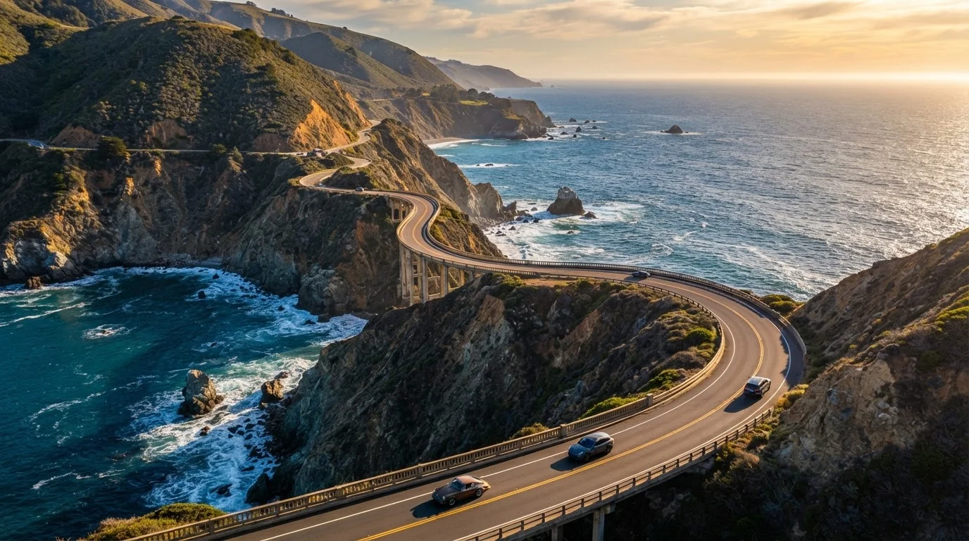
- Big Sur is the emotional centerpiece of the drive — Bixby Creek Bridge, McWay Falls, and Pfeiffer Beach are among the most photographed stops. Allow at least one full day here.
- Small-town culture
- Carmel-by-the-Sea, Cambria, and Cayucos offer a different rhythm — art galleries, local seafood spots, and uncrowded beaches worth lingering on.
- Wildlife moments
- Elephant seal rookeries near San Simeon are accessible year-round. Gray whale migrations run roughly November through May, with northbound whales passing March through May.
If you're curious how this coastal drive compares to an entirely different style of domestic adventure, our city break vs. national park trip framework is a useful thinking tool.
Lodging, Logistics, and Road Realities
Book lodging early — especially anywhere in the Big Sur corridor and Carmel. Options are limited by design (the area has resisted overdevelopment), so rooms fill weeks or months ahead during spring and fall. Camping is a genuinely popular and practical choice along this stretch; reservations through the California state parks reservation system are generally required.
Gas stations are sparse between Ragged Point and Carmel — roughly 90 miles of very limited services. Fill your tank in Cambria or Morro Bay before heading north into Big Sur, regardless of your current gauge reading.
Check Caltrans road conditions (the California Department of Transportation) before and during your trip. Highway 1 closures, particularly in Big Sur, are not rare. Landslides have historically closed sections for months at a time. A flexible itinerary is your best insurance.
For a counterpoint on road-tripping format, our road trip vs. fly-and-explore guide lays out the honest trade-offs of driving versus flying as your primary travel mode.
Entry Fees and Permits Vary by Park
Several state and national parks along the PCH corridor — including Julia Pfeiffer Burns State Park and Pfeiffer Big Sur State Park — charge day-use or parking fees. Some popular beaches and viewpoints require advance timed-entry permits during peak season. Check the California State Parks reservation system and the National Park Service website for current requirements before your trip.
Putting Your PCH Framework Together
A well-planned PCH trip comes down to four decisions made before you leave: season, direction, pace, and priorities. Once those are clear, your daily logistics flow from them naturally.
Start with your non-negotiables — Big Sur, a specific wildlife sighting window, a beach town you've always wanted to visit — and anchor your itinerary around those. Fill in the gaps with flexibility rather than over-scheduling every hour. The drive itself is the experience; many of the best PCH moments come from an unmarked pull-off discovered on a whim.
Keep your trip planning resources close as you build out the details. And if the coastal road-trip format excites you beyond California, consider that a multi-state Southern road trip offers an equally compelling but dramatically different American driving experience.
The Pacific Coast Highway doesn't require perfection to be extraordinary. Give yourself the time to slow down, and it will consistently deliver.